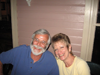
Leland, Cathy and Cinnamon. Notice their rig out of the window behind Cathy? It is housed in a HUGE pole barn the other half of which you can see behind Leland. It is a beautiful summer place in a lovely setting and we hope Leland enjoys cutting all that grass.
Leland and Nanc at Petrograph Cave State Park and a few of the petrographs. These drawings range from some that are prehistoric to others that where done in the 1800's
There are two caves at the park. On the right is Petrograph Cave where most of the drawings are located. Ghost Cave, on the left, had these huge round concretions that create a ghost like appearance. The concretions protrude from the rock all along the cliff and eventually fall to the ground below as the surrounding rock erodes away.
Part of our tour was along the rim that overlooks Billing and the Yellowstone River Valley below. What a great view. Amazing, no guardrails in sight.
Just down the road (and river) from Leland's and Cathy's is a famous Lewis and Clark Expedition landmark, Pompeys Pillar National Monument. Cathy and Nanc at a contemporary Teepee at the new Interpretative Center that was opened for the bicentennial of the expedition 2004 to 2006.
The center has excellent exhibits telling the story of the trip. The map shows the area of the Louisiana Purchase and the routes Lewis and Clark traveled. The flag is a replica of the 15 star, 15 stripe flag they carried. (This is the same kind of flag that flew at Ft. McHenry when the Star Spangled Banner was written.) The bull boat was made of buffalo hide tied over a frame. The Mandan taught them how to makes these boats. Part of the party had to make a bull boat to float down the Yellowstone when their horses were stolen. The compass is a replica of the one Lewis and Clark carried.
Pompeys pillar rises 150 feet above the surrounding land. Clark named it for the infant son of Sacagawea whom Clark called Pomp, which means Little Chief.
The thing that makes this landmark so significant is that it is one of a very, very few places where there is proof positive that the expedition passed this way. Clark recorded in his journal that he carved his name in the rock and you can still see that he was here over 200 years ago. He passed this way on the return from the Pacific when he and Lewis split the expedition to explore the Yellowstone River. I like the direct ties to historical events these kind of things give us. It is like seeing the original signatures of the signers of the Declaration of Independence and the Constitution at the National Archives.
The tradition of carving your name on the pillar continued into the middle 1900's. Of course, doing that today would result in a hefty fine and maybe even some jail time. I always wonder when graffiti or vandalism becomes historically significant. When I questioned the ranger, he said for this site anything prior to 1950. Interesting since 1950 doesn't really seem like that long ago. Heck, that is when Nanc was born and I don't consider her that old, she isn't even old enough to collect Social Security!!!
From the top you can see many of the same vistas Clark saw including three mountain ranges in the distant. We have been to several expedition sites on our travels and this one is one of the best.
It was great spending a couple of days with Leland and Cathy and a special thanks to them for being such great hosts and tour guides. Another visit made extra special seeing it through a native's eyes.


No comments:
Post a Comment