Sunday, April 30, 2017

Magnificent Monument Valley

Monument Valley has been on our to do list since we went on the road ten years ago. Our travel plans and the weather never aligned until this year. It turned out to be well worth the wait as it is a magnificent place. 
As we got close, Agathlan, an ancient volcano core near Kayenta is the first sign that we are in for something unique. In the 1800's Kit Carson, who was sent by the government to clear out the Indians, renamed it El Capitan. 
Our first view of the buttes and mesas of Monument Valley coming in from the West. Even though this is our first visit here, we have seen the place in so many movies it was like we had been here before.
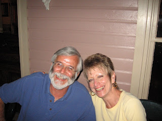
And look who else was here! Wallace and Wanda were the first SKPs we met at RV Boot Camp in 2007. We have crossed paths with them many times over the years including in 2014 in Alaska. They are heading back to Alaska to replenish their supply of fish. We had a nice time getting caught up and are looking forward to following their trip north.
Monument Valley is a place where you can sit and watch all day as the changing light changes the look of the landscape. The first morning I got up early and went to watch the sunrise.
Very neat seeing the sun peeking through the rocks and watching the color of the sky and clouds change as the sun came up.
This is the view from the East. You may recognize it from the movie Forrest Gump.
Down the road from the valley is the formation that gives the town, Mexican Hat, its name.
We were told the drive up Moki Dugway was not to be missed. The road was constructed in 1958 by a mining company to transport ore from the mine. The road climbs 1100 feet to the top of the mesa. It is gravel and while only three miles, it has many switchbacks and not one guardrail.
The view of the Valley of the Gods with its many temple like rock formations is spectacular. The road is limited to vehicles less the 28 feet and under 10,000 pounds. That said, we saw a couple of pickups pulling boats up the road. Moki Dugway is a neat drive that can even be done in a car.
Not sure if this is a natural hill or a pile of mine waste, but it looks like one of those sand art works from the 1960's.
We stayed at Goulding's Lodge, Trading Post, Restaurant, Gas Station, Grocery Store, Museum, Theater, Lodge and RV Park. Goulding's started as a trading post in a tent in 1924 by Harry and his wife Mike. 
When the Depression economy hurt their business Harry went to Hollywood with pictures of the valley landscape. He convinced director John Ford to shoot movies here helping the local economy. In 1939 Stagecoach was the first movie shot here. A few others are Easy Rider, Forrest Gump, Eiger Sanction, Thelma and Louise, The Lone Ranger and The Lego Movie. There is one room with exhibits of the many movies shot here. 
At the trading post Harry bartered with the Navajo for blankets, baskets and pottery to sell to tourists. The trading post is now a museum.
The John Wayne Cabin is where he stayed in 1939 during the filming of Stagecoach. He was in three other movies here over the years. Each evening at the Goulding's theater they show one of the John Wayne movies that was filmed here..
Classic view of the valley.
We did a couple short hikes from the RV Park. One went to this arch and another offered a view of the valley.
The valley is part of the Navajo Nation and many families still live there. You have to pay an admission which allows you to tour the museum and drive the loop road. We opted for a tour from the RV Park and were happy we did as the road is terrible. Here we are in front of the mittens. The right mitten has been used in car commercials.
The visitors center has a museum about the Navajo culture. Pictured are examples of male and female clothing and the Navajo Nation Seal woven in a basket. There is an excellent exhibit about the code talkers, Navajo who where used by the military during WWII to send messages over the radio in their native language. The Japanese never broke the code.
We opted for the sunset tour and where disappointed when a few clouds moved over the horizon blocking the sun as it set for most of the tour. It was still great, just not what we wanted.
The classic view from the visitors center.
Could be a scene from a movie or a look back 200 years ago. You can take horseback tours of the valley.
John Ford Point, the site of many movie scenes and commercials.
At every turn there are new and interesting views.
The Totem Poles at sunset.
This strong woman is not to be messed with. I don't think it fell over after we left. Monument Valley was everything we expected with the beautiful, ever changing landscape. It is a bit out of the way but well worth the drive.

Tuesday, April 25, 2017

Canyon de Chelly National Monument

Canyon de Chelly National Monument in Chinle, AZ has been on our to do list for quite some time and this visit lived up to our expectations. There are only two nearby campgrounds and we opted for Cottonwood which is near the canyon entrance. It is dry camping, but has paved sites and is the closest to town. Canyon de Chelly (d'SHAY) is not only a natural wonder but also an important cultural site that has been inhabited for nearly 5000 years by various native people. 
While the canyon is a National Park Service site it is on the Navajo Nation and administered by the Navajo. Entrance into the canyon is restricted to tours with rangers or authorized native guides. We opted for the four hour tour from the Thunderbird Lodge which was by the campground. They used this six wheel drive vehicle with an open top. 
You can see why we liked this vehicle. The Chinle Wash still had a good bit of water from the spring snow melt. This wash will be bone dry after the snow in the mountains is gone.
It does not look like much but one of our fellow tourist's hat blew off and when our guide Dave went back to get it we started to sink in the quicksand. He had to use all six wheels to get us out. Wish I had gotten a picture of that hat lying atop the quicksand looking like there could be a person under it just like an old Western movie.
The canyon has many pictographs (paintings on the rock) and petroglyphs (images carved into the rock). Some of the very old ones were done by the Anasazi, the oldest Puebloan people, and their meaning is unknown. Here are a snake, a flute playing kokopelli, a dancer and hands marking people's presence.
The petroglyph on the left is from the time the Navajo occupied the canyon from 1700. It tells the story of how they helped a warrior who suffered from what we today call post traumatic stress disorder. The Navajo believed that to help a person they needed to make a robe from a hide with no arrow or spear holes. They would run down the deer until it was exhausted and then stuff corn meal into its nostrils to suffocate it. Then the undamaged skin would be made into a robe for the warrior.  
There are many ruins in the canyon dating back to the time of the Anasazi. The round structure in the middle is a kiva that was used for ceremonies. 
While the land inside the canyon is owned by many Navajo families who use it for farming and herding, very few people actually live there. They mainly use it in the summer when the kids are not in school since daily trips in and out of the canyon are very difficult.
More old ruins. While these early people were often called cliff dwellers, they where really Puebloans who built these communities (pueblos) on the canyon floor as well as in the walls. 
This is Navajo Fortress. In the late 1700's warfare erupted between the Navajo and the Spanish. When their efforts to fortify the lower canyon failed many went to the top of this butte for protection. Then in 1846 the US Army drove the Mexicans out and the area became part of the United States.   
This is the back of Navajo Fortress. Click on the picture to enlarge it and you can see a tree ladder they used to climb to safety. In 1863 the US Army under Kit Carson drove the Navajo out and destroyed the orchards and killed all there animals. They were marched 300 miles, known as The Long Walk, to Fort Sumner, New Mexico. They were allowed to return in 1868 but were dependent on the government since their property had been destroyed.
This pictograph shows the story of the Spanish coming into the canyon to attack the Navajo. The middle figure is the priest who accompanied the soldiers.
 This is a hogan that would be used by families during their trips into the canyon. There are forty Navajo families that own property inside the canyon. This ownership dates back to the time before the Spanish. A tour into the canyon is a must to get an understanding of the Navajo culture and the history in the area.
On day two we drove the canyon rim and hiked to the floor to see the White House ruins up close.
This is the only trail you are permitted to hike into the canyon. You can see the trail, farmland and Chinle Wash. There are two main canyons and a few smaller side ones. The main canyon was the only one that had water in it, even now in early spring.
The trail has two tunnels, one at the top to get over the rim and one at the bottom to get to the floor of the canyon. They say the hike is 2.5 miles but we found it to be a bit longer. It is 600 feet to the bottom.
The White House ruins gets it name from the white adobe on the house in the back. The lower part here is on the canyon floor near the wash.
What goes down must go up. Looking from the bottom to the rim. The trail is pretty easy with many switchbacks meaning it is not very steep.
Spider Rock rises over 800 feet from the canyon floor at the junction of Canyon de Chelly and the smaller Monument Canyon. One of the things that makes Canyon de Chelly unique is you can see the mouth of the canyon, which was near the campground, and then within a few miles you can look down on to the top of this 800 foot spire.
While White House Trail is the only one you are allowed to hike down into the canyon we found a couple others. Look carefully and you can see a trail along the opposite wall and then down a ladder into the cut that is partly in shade. At the bottom you can see the line of the path through the trees. It is not a trail for the faint of heart. 
Looking down on the farmland where they grow crops along the Chinle Wash. It is hard to believe ancient people could survive and thrive in such a harsh climate but then you realize the Navajo continue to thrive in the same conditions today. 
Massacre Cave is the site where the Spanish killed about 115 Navajo who took shelter there. The Spanish discovered them and killed them all by firing down from the rim above. We really liked Canyon de Chelly and seeing all the ancient dwellings from a distance has us looking forward to visiting Mesa Verde where we can get an up close look.

Because we have been busy and have had slow internet connections I'm a bit behind with the blog. We have been to Monument Valley (our next post) and are now in Cortez, CO for a week to explore Mesa Verde and the area.

Monday, April 17, 2017

Family in DC - Friends in ABQ

As I said in an earlier post, we decided to fly to Washington, DC to see Nanc's younger sister who was recently diagnosed with cancer. It was her birthday and her other siblings were also there. We had a great weekend getting caught up and are happy to report that Michelle is doing very well. We left Albuquerque at 6am on Delta and were fortunate to make it to Washington as it was the day Delta had cancelled nearly 3,000 flights.
Jim, Nanc, Keith, Dave, Michelle, Judy and Braedon out to dinner. We have not all been together for a couple years so there sure was a lot of reminiscing and story telling going on. 
My new friend Spartacus, Sparta for short. He is a labradoodle who is more of a lap dog than the warrior his names implies. He did enjoy having many people to throw the ball and Frisbee.  
We did a day trip to Old Town in Alexandria. The weather was beautiful and we walked along the river and just soaked up the sun. It was the weekend of the Cherry Blossom Festival so we stayed out of downtown Washington. 
The four Scott siblings Judy, Dave, Nanc and Michelle. Judy drove in from Ohio, Dave flew in from Seattle and Nanc and I flew from Albuquerque.
Dave's grandson, Braedon, has become his traveling partner. They have been on several trips together. He is a great kid even though he is a Seahawks fan.  He sure has changed since we last saw him in 2009. 
Another day we visited National Harbor. This is The Awakening, a very neat sculpture that used to be in East Potomac Park in the city. We always took the seventh graders there on the DC field trip. 
National Harbor is a newer, commercial development with a convention center, hotels, shops and restaurants. My favorite store is Peeps. Here is the link to the Washington City Paper winners of the diorama contest that uses "Peeple" to celebrate current events. The contest has been a favorite of ours for years and it was neat seeing some of the entries.
A few of the statues at National Harbor; Henry Ford, Churchill and FDR, Rosie the Riveter, Abraham Lincoln and Frederick Douglass.
Our yacht awaits. The Capital Wheel is 180 feet high and offers fantastic views of  the sites in nearby Washington. We opted to keep our feet on the ground.
The whole gang was on hand. We had a great time making Michelle's birthday a weekend long event. She has just started a new treatment and seems to be tolerating it much better than the chemo she had been undergoing. We were so happy that she is doing well and have already made plans to see her and Keith in North Carolina in July.
Family portrait Keith, Sparta and Michelle. We all had a fun time sharing stories and laughing about all the crazy things we have done over the years. They were great hosts putting up with all our foolishness. 
This was as close as we got to the city, taking off at National Airport. I love having a window seat to watch the world pass by and how the land changes as you fly over America.
I enjoy trying to pick out places I know. This is Snowshoe Ski Resort in West Virginia. Nanc's skiing days ended at the bottom of Cupp Run, the long slope on the right, when she went down and tore up her knee.
 Flying east to west the land changes from forest to farm to prairie with the big crop circles showing where the climate gets dry. I could see a lot of windmills even in the oil fields of West Texas.
During our first year on the road we contacted Larry Stone whom I worked with at my first teaching job. At that time it had been nearly 30 years since we had seen him. We got together with Larry and Amy and now try to see them every time we are in Albuquerque. Since we were here for an extended stay we invited them for dinner and really enjoyed spending a few hours relaxing and getting caught up on all that has been happening in our lives. As we always say, seeing friends and family while traveling has become the best thing about our RV lifestyle.  

We are leaving Albuquerque and have reservations in Canyon de Chelly, Monument Valley and Cortez, Colorado over the next couple of weeks. We will have limited Internet coverage at the first two stops this week but, hopefully, I won't get too far behind on the blog.